pdf NET&T New England Toll Route Map - i7 Jun 1967 Popular
By Paul F 303 downloads
NETT_NE_Toll_Route_Map_i7_jun67_tci.pdf
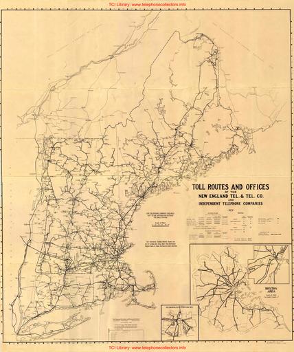
A rare New England Telephone & Telegraph Company Toll Route map covering MA, VT, ME, and RI including neighboring SNET (CT) territory. Also includes facilities of AT&T. Richly detailed including office type (Magneto / Manual Common Battery / Dial). A tremendous amount of information covering a large area. Includes vintage radio links to Block Island and Nantucket. Originally issued in Sep. 1942. Contributed by Rick Walsh.
New User?
Read the articles under "Introduction" in the black menu bar above.
Recent Contributors
Thanks for new documents from Bruce Patterson, Jon Kolger, Paul Ivester, Len Hicken, Paul Fassbender, Fred Haynes, Kurt Rudolph, Wade ("Kellogg KITT"), the Connections Museum, Rick Walsh, Jeff Lamb, Jeremy Walters, Mark Cuccia, Alan David, Harry Joseph, Charlie Terry, Karl Brose, Dennis Hock, Tim Griffin, Remco Enthoven, and Steve Cichorsky.
Please send a file to add your name to this list!
Who's online
We have 471 guests online