pdf SNET Toll Route Map - 1957 Popular
By Paul F 291 downloads
SNET_Toll_Route_Map_1957_tci.pdf
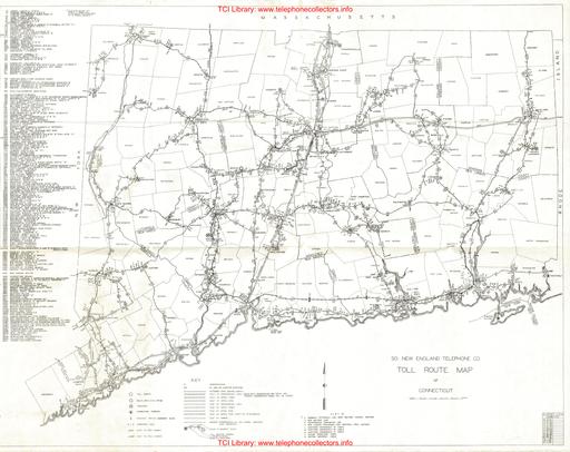
A well detailed vintage map of Southern New England Telephone Company facilities and those of AT&T in Connecticut including Toll offices. Cable type (Open wire / Aerial / Underground) is illustrated. Originally issued in May 1932. Contributed by Rick Walsh.
New User?
Read the articles under "Introduction" in the black menu bar above.
Recent Contributors
Thanks for new documents from Bruce Patterson, Jon Kolger, Paul Ivester, Len Hicken, Paul Fassbender, Fred Haynes, Kurt Rudolph, Wade ("Kellogg KITT"), the Connections Museum, Rick Walsh, Jeff Lamb, Jeremy Walters, Mark Cuccia, Alan David, Harry Joseph, Charlie Terry, Karl Brose, Dennis Hock, Tim Griffin, Remco Enthoven, and Steve Cichorsky.
Please send a file to add your name to this list!
Who's online
We have 304 guests online